
Anúncios
Introduction to Earth Observation from Space
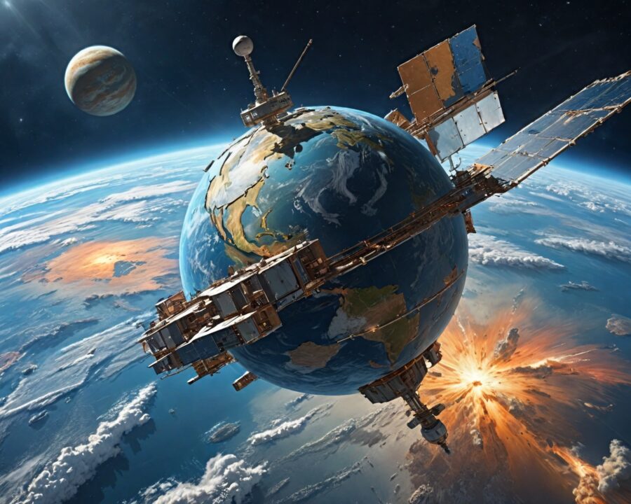
The vastness and complexity of our planet have long captivated the human imagination. From ancient civilizations interpreting celestial movements to modern-day scientists exploring planetary frontiers, the quest to understand Earth has been relentless. In recent decades, one of the most groundbreaking advancements in this pursuit has been the use of satellites to observe our planet from space. These orbital observers provide a vantage point like no other, delivering critical data that shapes our understanding of Earth and enhances our ability to manage its resources.
Satellites observing Earth from space have revolutionized numerous fields, from environmental science to global communication. They offer insights into everything from weather patterns to deforestation, urban development to ocean currents. This article delves into the intricacies of how satellites observe Earth from space, exploring the technology behind them, the types of satellites used, and their significant applications in various aspects of daily life. As we further develop these technologies, the implications of satellite observation continue to grow, promising a deeper comprehension and stewardship of our home planet.
Anúncios
How Satellites Capture Images of Earth
Satellites capture images of Earth using a sophisticated array of sensors and imaging technology. These systems are designed to work remotely, acquiring detailed data from the unique perspective of space. At the core of satellite imaging is the concept of capturing electromagnetic radiation reflected or emitted from Earth’s surface; this can encompass visible light, infrared, and radio waves, each offering different insights.
Imaging sensors on satellites commonly include multispectral and hyperspectral cameras. Multispectral cameras can capture images in multiple wavelengths across the visible and non-visible spectrum. These images are invaluable for tasks such as analyzing vegetation health, water quality, and soil properties. On the other hand, hyperspectral sensors capture data across a much wider range of wavelengths, providing detailed information about the chemical makeup of the observed surfaces.
To translate the gathered data into usable images or datasets, sophisticated algorithms and computer processing are employed. The raw data collected by satellites must be processed to correct for any distortions caused by the atmosphere or the movement of the satellite. This processed information can then be used in a wide variety of applications, from creating maps to monitoring environmental conditions in near real-time.
Types of Satellites Used for Earth Observation
Various types of satellites are deployed to observe Earth from space, each serving different functions based on their design and the nature of their mission. The major classifications include geostationary satellites, polar-orbiting satellites, and nanosatellites.
Geostationary Satellites
Geostationary satellites orbit Earth in line with the planet’s rotation, hovering over the same spot on the equator at all times. This stationary position allows for constant observation of specific areas, which is essential for applications such as weather monitoring and telecommunications. They can capture a broad view of weather systems and are fundamental in meteorology for tracking storms as they progress.
Polar-Orbiting Satellites
Polar-orbiting satellites circle Earth in a path that takes them over the poles. These orbits allow these satellites to scan the entire planet systematically, over time, as Earth rotates underneath. They are typical for detailed environmental monitoring, mapping, and Earth system science due to their ability to capture detailed surface data as their orientation gradually changes.
Nanosatellites
Nanosatellites, often part of large constellations, provide a relatively cost-effective method for Earth observation. Despite their small size, these satellites are equipped with increasingly sophisticated instruments, providing high-frequency data crucial for monitoring rapidly changing environments, such as urban development or the effects of climate change.
Key Technologies in Satellite Imaging
The technological framework behind satellite imaging is sophisticated, integrating advancements in optics, data transmission, and image processing. Several key technologies define how satellites observe Earth from space effectively and accurately.
Optical Sensors
Optical sensors play a pivotal role in capturing high-quality images. They operate similarly to digital cameras, capturing light reflected from Earth’s surface. The quality and resolution of the images depend on the sensor’s design, including its spectral range and spatial resolution. Innovations like adaptive optics and advanced digital signal processors continue to push the limits of what these sensors can achieve in terms of clarity and detail.
Radar Sensors
Radar sensors use microwaves to generate images, capable of penetrating clouds and darkness. This ability makes them invaluable for consistent monitoring regardless of weather conditions or time of day. Synthetic Aperture Radar (SAR) technology is an example, providing detailed imagery by using movements of the satellite itself to simulate a larger antenna or aperture than is actually there.
Data Transmission and Processing
Data transmission from satellites requires robust communication systems, often relying on radio waves. Transmission must be fast and secure, ensuring that data reaches Earth-based stations for processing. Image processing technology is then crucial for converting raw data into meaningful formats. Techniques such as pixel classification, image enhancement, and pattern recognition help translate data into images and maps usable by scientists and policymakers.
Applications of Satellite Data in Daily Life
The impact of satellite data extends into myriad facets of everyday life, from agriculture to urban planning. Below are some key applications:
Environmental Monitoring
Satellites play a critical role in tracking environmental changes. They help monitor deforestation rates, map out protected areas, and assess biodiversity. Satellite imagery provides vital data for understanding ecological patterns and managing natural resources sustainably.
Agriculture
Precision agriculture relies heavily on satellite data to optimize farming practices. By analyzing variations in crop health, soil moisture levels, and weather patterns, farmers can make informed decisions, enhancing crop yields while reducing resource inputs like water and fertilizers.
Urban Development
Urban planners use satellite data to manage and design cities better. With insights into land use patterns, transport networks, and population density, planners can make data-driven decisions that encourage sustainable city growth and improve infrastructure.
The integration of satellite technology into these everyday areas underscores its ubiquity and necessity in modern societal operations, driving efficiency and innovation.
How Weather Satellites Monitor Climate Changes
Weather satellites are pivotal in both short-term weather forecasting and long-term climate monitoring. Positioned strategically in geostationary and polar orbits, they capture real-time data crucial for understanding atmospheric dynamics.
Real-time Weather Forecasting
Weather satellites provide continuous, up-to-date information on atmospheric conditions. This data allows meteorologists to predict weather patterns, monitor storms, and issue timely warnings to mitigate the impact of severe weather. Key data includes cloud cover, wind speeds, and surface temperatures, enabling forecasts that inform everything from daily commutes to disaster preparedness plans.
Climate Monitoring
Beyond short-term forecasting, satellites observe changes in the climate system over longer periods. They track variables like sea surface temperatures, polar ice coverage, and greenhouse gas concentrations. This long-term data is essential for climate research, helping scientists model future climate scenarios and assess the impacts of global warming on various ecosystems and human societies.
Enhanced Climate Models
The data gleaned from these weather satellites feeds into sophisticated climate models that simulate Earth’s climate system’s behavior. These models are crucial for predicting future climate conditions, informing global policy decisions, and guiding efforts to mitigate climate change effects.
The Role of Remote Sensing in Disaster Management
When disasters strike, timely and accurate information is crucial for effective response and recovery. Remote sensing technology, largely powered by satellites, offers a comprehensive tool for disaster management.
Early Warning Systems
Satellites provide the ability to monitor potential disaster zones in real time, such as identifying the early signs of hurricanes, earthquakes, or volcanic eruptions. This data enables the formulation of early warning systems, giving authorities the precious time needed to evacuate communities and implement safeguarding measures.
Damage Assessment
Post-disaster, remote sensing is essential for assessing damage over vast and sometimes inaccessible areas. High-resolution imagery can quickly and accurately evaluate the extent of damage to infrastructure, housing, and natural landscapes, facilitating efficient allocation of emergency services and resources.
Recovery Planning
In the longer term, satellite data supports the planning and implementation of recovery strategies. Monitoring land rehabilitation, ecosystem recovery, and rebuilding efforts ensures that reconstruction is resilient and sustainable, minimizing the risks of future disaster impacts.
Common Misconceptions About Satellite Observation
Despite the ubiquity of satellite technology, several misconceptions persist about how satellites observe Earth from space. Disentangling these myths is crucial for appreciating the capabilities and limitations of this technology.
Satellites Can See Everything in Detail at All Times
A common misconception is that satellites can see everything on Earth with high precision at all times. In reality, satellites have specific orbits and scopes, and cloud cover or darkness can obscure visibility in optical sensors, though radar technology helps mitigate these limitations.
Satellite Imagery is Instantaneous
Another myth is that satellite images are acquired instantaneously. The process involves significant data collection, transmission, and processing, which can lead to delays between image capture and availability. Some satellites provide near-real-time data, but it still involves a process.
All Satellites are Owned by Governments
Although government agencies operate many satellites, especially in the realms of meteorology and defense, a growing number are launched and maintained by private companies. These commercial satellites have expanded access to satellite data across industries.
Challenges in Satellite-Based Earth Observation
While satellite observation has greatly enhanced our ability to understand and manage Earth’s systems, several challenges persist.
Data Overload
The sheer volume of data generated by Earth observation satellites poses a significant management challenge. Efficient processing and storage solutions are critical to handling this data, ensuring it remains accessible and usable for diverse applications.
Technical Limitations and Costs
Developing and launching satellites are resource-intensive, and technical failures can result in substantial financial loss. Additionally, maintaining a satellite network requires continuous investment in technology to keep pace with advancing scientific needs.
Privacy and Ethical Concerns
The capability of satellites to capture detailed images of any point on Earth raises privacy concerns. There are ongoing discussions and regulations about what is permissible in terms of observation, balancing the need for information with privacy rights.
Future Advancements in Satellite Observation Technology
The future of how satellites observe Earth from space promises exciting advancements, driven by technological innovation and expanding industrial applications.
Miniaturization and Cost Reduction
Miniaturization is revolutionizing satellite technology, making satellites smaller, lighter, and less expensive without compromising capabilities. This trend will likely lead to the proliferation of satellite networks, increasing data availability and redundancy.
Artificial Intelligence Integration
Artificial Intelligence (AI) is set to enhance satellite data processing significantly. AI algorithms can automate image analysis, recognizing patterns and anomalies more quickly and accurately than human operators, thereby increasing the efficiency of data usage.
Advancements in Remote Sensing Technologies
New sensor technologies, such as which new combinations of spectral bands or quantum-based sensors, offer the potential for more detailed and diverse data collection. These developments could vastly improve our understanding of Earth’s complex systems.
Frequently Asked Questions
How do satellites stay in orbit?
Satellites remain in orbit due to their tangential speed and the gravitational pull of Earth. The speed of a satellite allows it to fall towards the Earth at the same rate that the Earth curves away beneath it, creating a stable orbit.
Can satellites see inside buildings?
Satellites cannot see inside buildings. They can capture images of rooftops and building surroundings, but the penetration of the building envelope is beyond the capability of current satellite imaging technologies.
How often are satellite images updated?
The frequency of satellite image updates depends on the satellite’s orbit. Geostationary satellites provide continuous monitoring of an area, while polar-orbiting satellites may take days to reimage the same spot due to their global coverage paths.
Are all satellite images available to the public?
Not all satellite images are publicly available. Some satellites are operated by government agencies with restricted data access policies, while others are commercial, providing data under specific licensing agreements.
Can weather satellites predict natural disasters?
Weather satellites help monitor conditions leading to natural disasters but cannot predict them per se. They provide necessary data to forecast weather systems, which can be instrumental in predicting events like hurricanes or severe storms.
Recap
In summary, how satellites observe Earth from space is a topic that encompasses the application of advanced technological systems to capture invaluable data about our planet. From multispectral imaging and radar sensors to the integration of AI in data processing, the technologies involved are at the cutting edge of science and engineering. These advancements facilitate multiple applications in environmental monitoring, agriculture, urban planning, and disaster management. Despite challenges such as data overload and privacy concerns, the future of satellite observation holds promise for enhanced accuracy and application, driven by innovations such as miniaturization and AI integration.
Conclusion
The era of satellite-enhanced Earth observation is a testament to human ingenuity and the relentless pursuit of knowledge. Satellites provide an unparalleled perspective on our planet, delivering crucial insights that inform scientific research, policy-making, and socioeconomic planning. As we face global challenges such as climate change and environmental degradation, the role of satellites becomes even more critical.
Future advancements in satellite technology promise not only increased data availability but also improved integration with technologies like AI and quantum computing. These innovations will likely redefine our capabilities in observing and understanding Earth’s complex systems, ushering in a new age of exploration and discovery.
As we continue to navigate the complexities of life on Earth, satellites remain our silent guardians in the sky. They offer not just a view into our present state but provide the foresight to build a resilient and sustainable future for generations to come.